Hiking Around Las Vegas; Tule Springs Fossil Beds National Monument
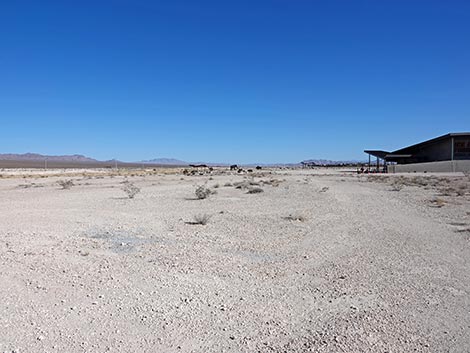
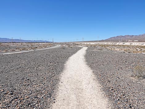
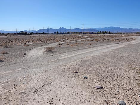
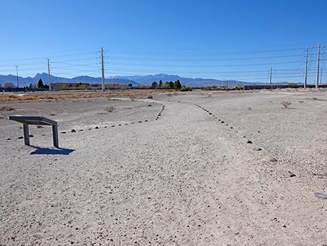
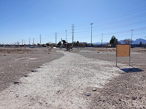
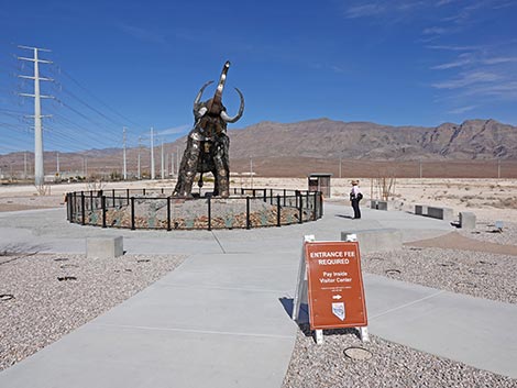 Trailhead at the Monumental Mammoth (view N) |
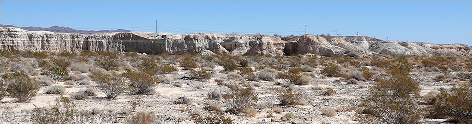
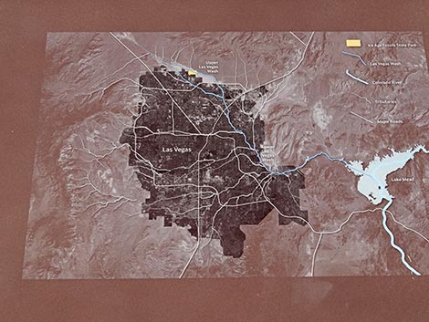
Overview Ice Age Fossils State Park was established in 2017 and opened to the public in 2024. This small (315 acre) state park is tucked up against the much larger (22,650 acres) Tule Springs Fossil Beds National Monument. Together, they protect the paleontologically rich Upper Las Vegas Wash, but in particular, the State Park protects the major paleontological excavation sites. The Las Vegas Wash Trail doesn't explicitly visit paleontological sites; rather, it explores the environment and presents geologic evidence showing how the landscape has changed over the millennia. As described by the State Park, "hikers will experience the natural forces that created and reshaped this landscape." The Las Vegas Wash Trail is a 1.5-mile, partial-loop trail that begins and ends at the Monumental Mammoth and loops out through the Upper Las Vegas Wash. The wash is dry most of the year, but it can be muddy after rainstorms. Two structures provide three shade-stops along the trail. Link to Trail Map or State Park Map. |
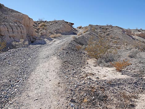
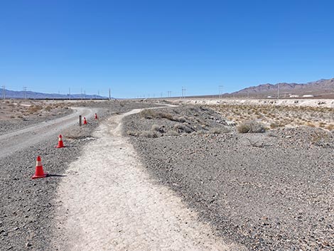
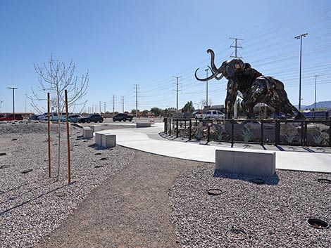
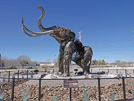 Passing east of the Monumental Mammoth (view NW) |
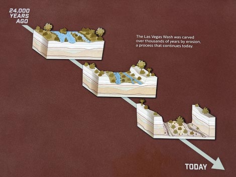
To appreciate this trail, it is useful to understand the basic geologic history of this area (adapted from the State Park website): At the coldest time during the last Ice Age, some 25,000 years ago, the Las Vegas area was wet and green with marshlands covering much of the valley. On this well vegetated landscape, herds of ancient bison, horses, camels, Columbian mammoths, and other large creatures, collectively referred to a megafauna (i.e., big animals), roamed across Las Vegas. All of these creatures are now extinct. Over time, the climate changed to become warmer and dryer. The wetlands began drying up, leaving behind spring-fed streams and riparian corridors with desert vegetation in dry areas. By the end of the last Ice Age, roughly 12,000 years ago, the megafauna were disappearing. Around this time, humans arrived, or at least began to leave their marks, in the Las Vegas Valley. These early humans walked among the remaining megafauna. The land continued to warm and dry as time moved on. The riparian corridors were replaced by the desert washes and desert plant and animal communities that we see today. Larger streams carved into the valley floor, creating deep washes, like the Las Vegas Wash, with pockets of badlands along the banks. The land continued slowly being shaped by nature for several thousand years before it became a State Park. |
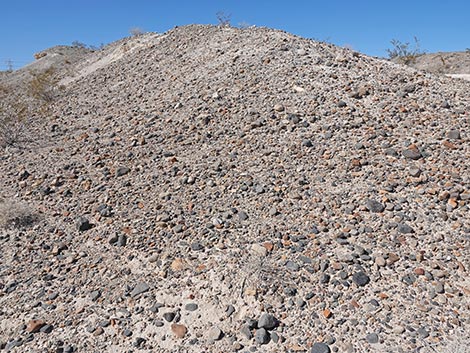
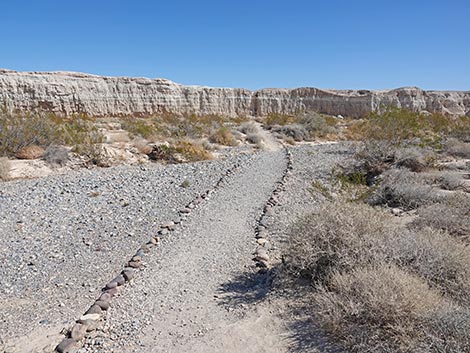
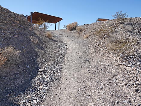
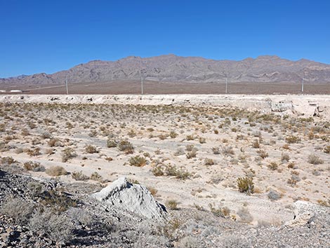
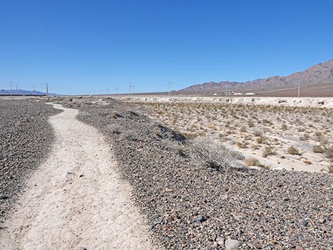
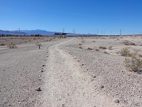
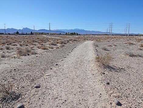
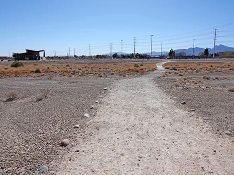
 The trail continues out past the Monumental Mammoth (view N) |
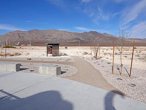
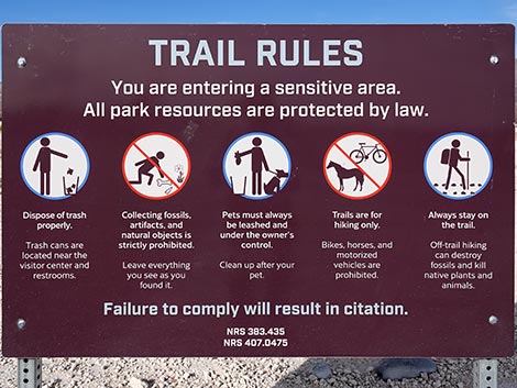
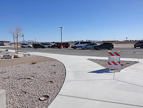
Watch Out Other than the Standard Warnings about hiking in the desert, this trail is fairly safe and short, but there are stairs and other places where hikers could trip and fall, so alway watch your footing. If the weather is stormy, watch for flashfloods in the wash. While visiting the area, please Respect the land and the other people out there, and try to Leave No Trace of your passage. Also, even though this area is not remote, be sure to bring what you need of the 10 Essentials. Please pay attention to the special State Park trail rules. Getting to the Trailhead Ice Age Fossils State Park is located on the north edge of the Las Vegas urban area. From downtown, drive north on Highway 95 towards Reno. Towards the northwest edge of town, take Exit 91A onto Clark County 215 (Northern Beltway). Now driving east, continue 3 miles to Exit 41 (Decatur Blvd). Turn left onto Decatur and drive north about 3.2 miles to Ice Age Fossils State Park, on the right. There is no big entrance sign, but watch for the Monumental Mammoth, which is big enough to be seen from a distance. Turn right into the parking lot. Park here; this is the trailhead. |
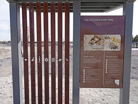
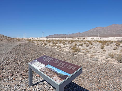
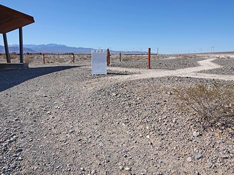
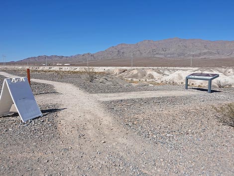
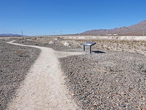
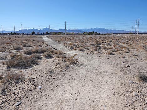
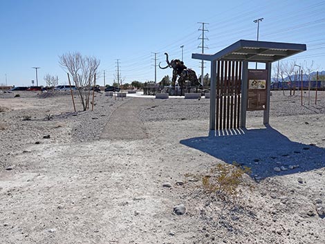
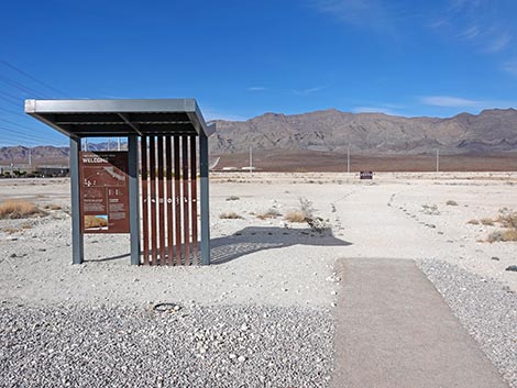 Trailhead kiosk (view N) |
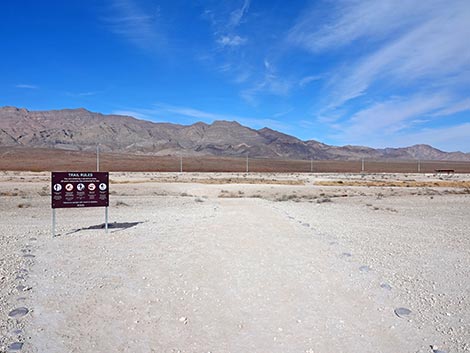
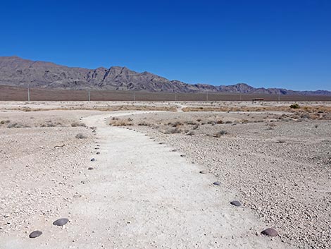
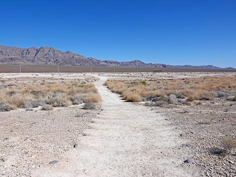
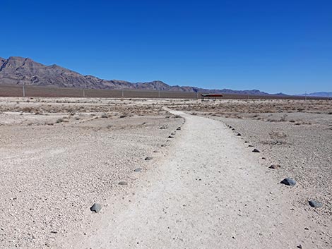
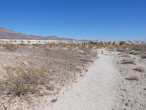
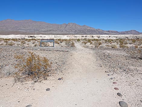
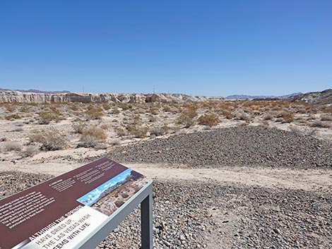
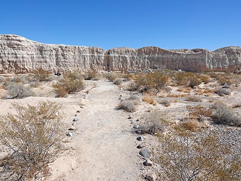
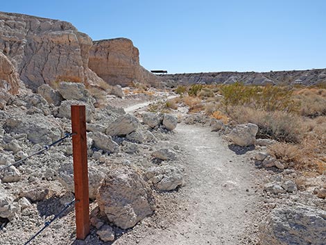
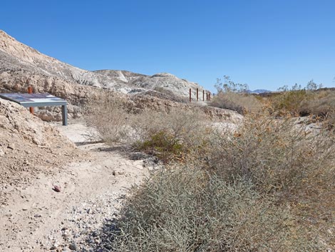
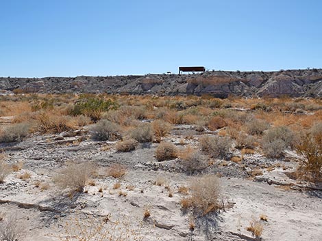
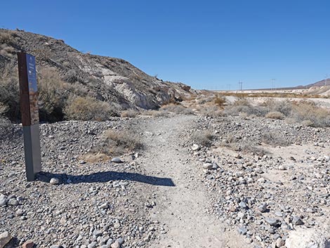
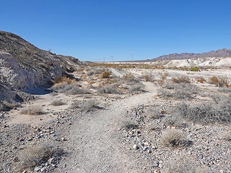
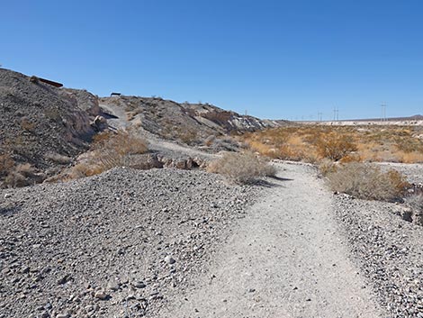
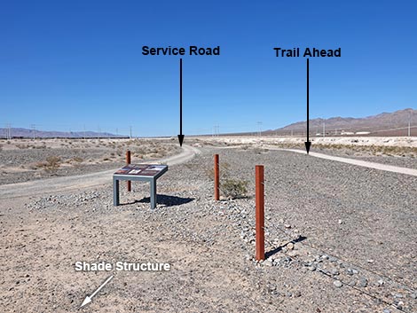
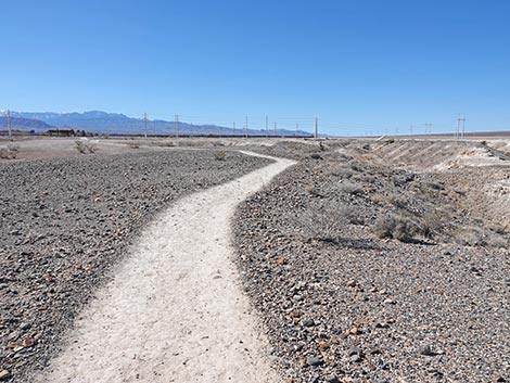
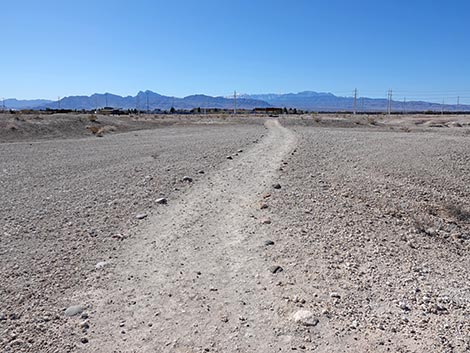
The Hike From the trailhead (Table 1, Waypoint 10) at the edge of the parking lot adjacent to the Monumental Mammoth, the Las Vegas Wash Trail starts by heading due north around the east (right) side of the Monumental Mammoth. Trail runs out into the desert a few yards to the trailhead information kiosk, which provides a map and information about the trail, and it invites hikers to descend into a wash and explore 100,000 years of geologic history. Note that the map on the sign indicates following the loop portion of the trail in the clockwise direction. Hikers can walk the loop in either direction, here the description follows the map directions. Continuing north, the Las Vegas Wash Trail runs out across a fairly flat landscape composed of ancient mud deposits where few plants can grow. A few Creosote Bushes and White Bursage survive these hot, poor soils, plus one or two Nevada Ephedra and Spiny Menodora. Soon, the Las Vegas Wash Trail passes a Trail Rules sign and continues northeast. In this area, be sure to look east and notice the ghosts of megafauna past in the distance. The megafauna sculptures on the Megafauna Trail give hikers an idea of what it looked like here with these creatures roaming a marshy landscape. Of course, we have to imagine the ponds and vegetation, but it is an interesting sight. |
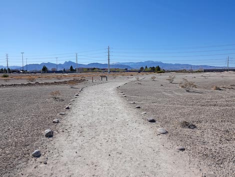
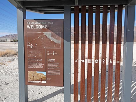 Trailhead kiosk sign and artwork (view N) |
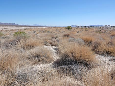
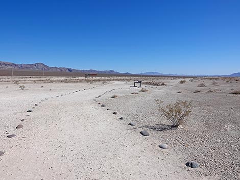
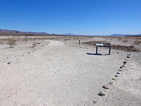
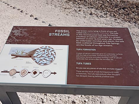
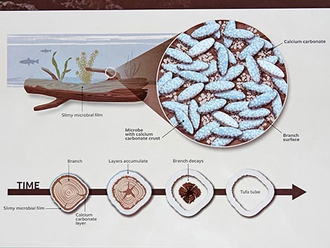
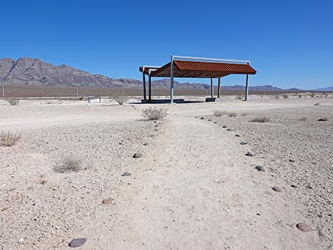
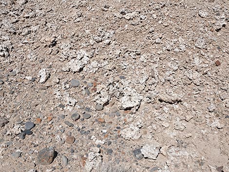
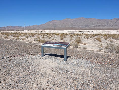
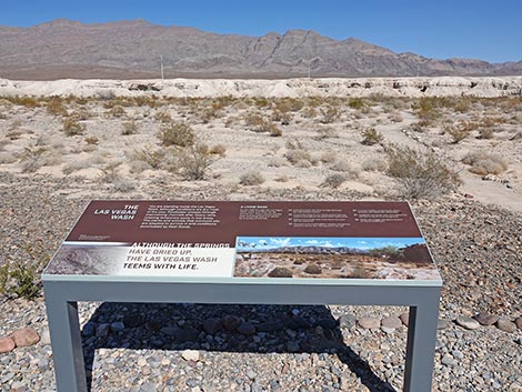
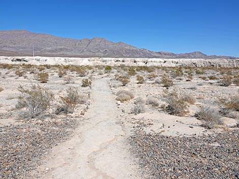
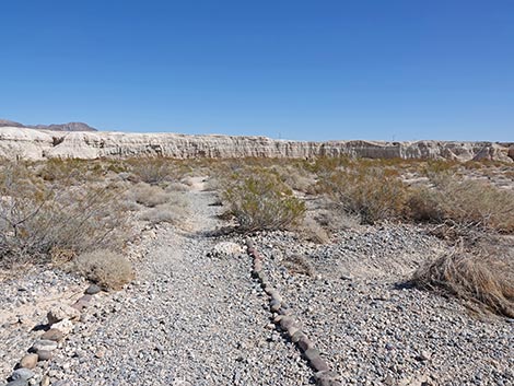
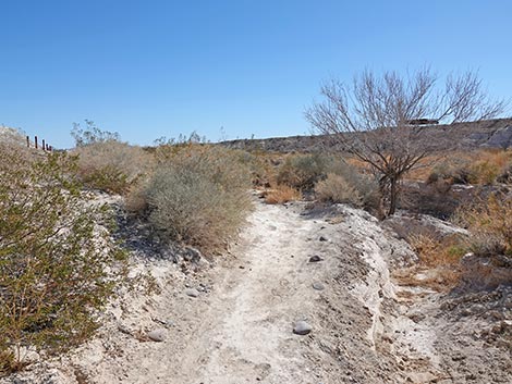
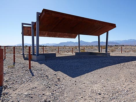
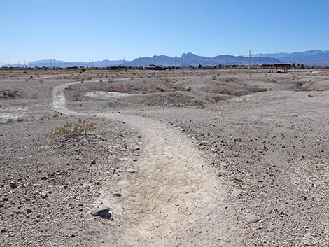
Crossing the ancient mud fields, the Las Vegas Wash Trail dips to cross a shallow swale. Notice how the vegetation responds where rain water accumulates. The swale supports a dense swath a desert bunchgrass: Big Galleta Grass. Hikers might also notice one or a few each of Mojave Rabbitbrush, Nevada Ephedra, Spiny Menodora, Littleleaf Ratany, White Bursage, Desert Globemallow, Creosote Bush, and Red Brome (an invasive grass), and even Side-blotched Lizards. The Las Vegas Wash Trail continues northeast to arrive at the first of several information signs along the hike. Here, the sign provides information about tufa that formed in marshlands and streams. Algae growing on the stream bottoms and things in the water caused calcium carbonate to accumulate on the stream bottoms and on plants growing in the water. The calcium carbonate accumulated to become tufa. The ancient stream channels can be recognized in the mudhills by linear deposits of tufa. Here, park staff piled up tufa to make it look like an old stream channel. Although not a natural feature here, natural tufa stream channels can be seen in several places in the area. The trail continues northeast, dipping through another narrow swale, crossing a service road, and arrives at a shade structure. During warm weather, use the shade while you have it. |
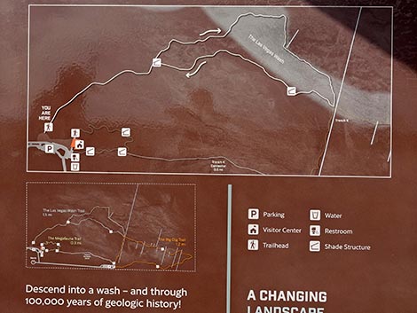 Trailhead kiosk overview map (view N) Trailhead kiosk overview map (view N) |
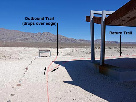
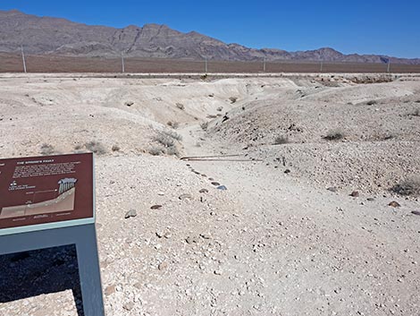
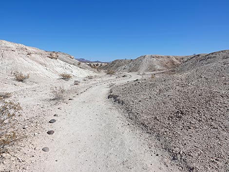
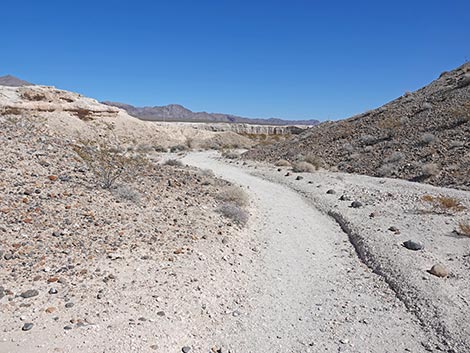
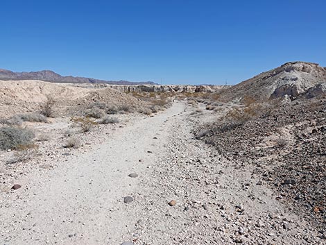
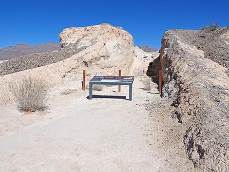
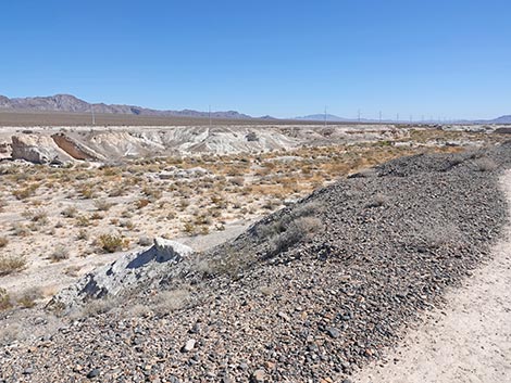
The shade structure sits at the edge of bluffs overlooking Upper Las Vegas Wash, and just beyond, an information sign provides information about Ice Age Tule Springs with an image of what the marshes might have looked like as well as a geologic representation of how rain and snow in the mountains moves through the ground to emerge as springs here. There is no trail junction sign, but adjacent to the Ice Age Tule Springs sign, the Las Vegas Wash Trail splits (Wpt. 11) to begin the loop. In the official clockwise direction, the trail continues by dropping over the edge of the bluffs to wind down a canyon. The return trail, coming in from the right, is well marked with stones and runs along the top of the bluffs. For rebellious hikers, the trail can be walked in the opposite direction. Running down the canyon into sculpted badlands, hikers will notice gravels on the side slopes. There gravels were once the bottom of an Ice Age stream that have eroded out of the hillside. A bit farther down the trail, hikers will notice layers of tufa atop the badlands with eroded chunks of tufa accumulating on the side slopes. These tufas were originally deposited in lakes or marshlands. |
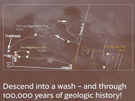 Trailhead kiosk detail map (with edits, view N) |
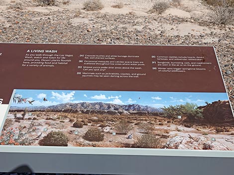
Soon, the Las Vegas Wash Trail breaks out of the side canyon and emerges onto the edge of Upper Las Vegas Wash (Wpt. 12) and arrives at another information sign: The Las Vegas Wash. Here, hikers will learn about the plants and animals that live in the modern Las Vegas Wash and surrounding landscape. Continuing north into the wash, hikers will notice the relatively lush vegetation compared to atop the mud hills. This is because there is more water in the wash than in the mud hills, and because the soils here are better. The common shrub species here include Creosote Bush, White Bursage, Mojave Rabbitbrush, and Cattle Saltbush. Also watch for Catclaw Acacia, Sweetbush, Smooth Threadleaf Ragwort, Desert Globemallow, Cheesebush, Desert Princesplume. White-tailed Antelope squirrels, Say's Phoebe flycatchers, and Rock Wrens might also be seen. Crossing the Main Branch of Las Vegas Wash, hikers will see the gravel bottom of the wash. Recall the gravels eroding from the hillsides in the side canyon that the trail came down; this is what those gravels originally looked like. |
 Backside of trailhead kiosk sign with more information (view S) |
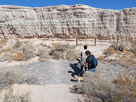
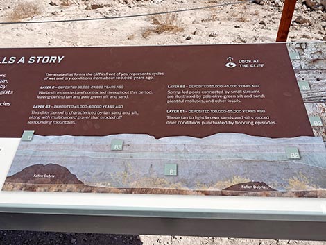
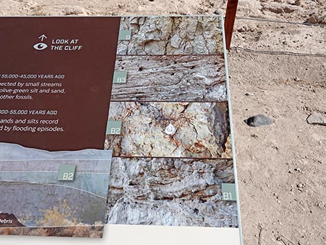
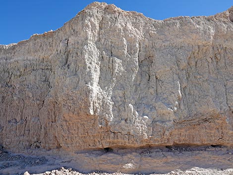
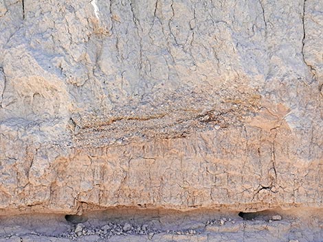
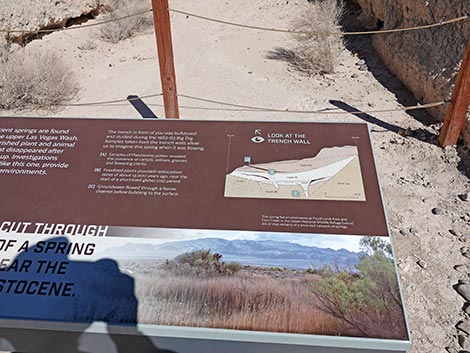
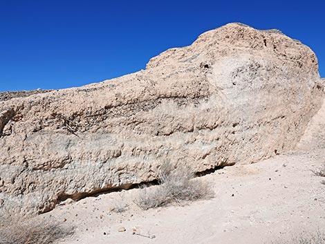
The Las Vegas Wash Trail winds north across the wash and encounters three stairs down into the North Branch of Las Vegas Wash where hikers will encounter a narrower strip of gravel in the wash bottom. Three more stairs led hikers out of the wash onto the north bank (Wpt. 13). The Las Vegas Wash Trail turns east to run between mud cliffs and the wash. Hikers might notice layers in the cliffs, and soon the trail arrives at another information sign: Every Layer Tells a Story. Here, the sign has a schematic outlining four layers that can be seen in the wall behind the sign. Hikers can a dark layer at the top, then a thin light layer, a more jumbled mud layer, and a more coarsely striated layer at the bottom. The sign puts ages on the layers and describes how they were formed. Continuing east along the base of the cliffs, hikers will see a shade structure atop the bluffs across the wash. The trail will continue up the wash a bit past the shade structure, then loop around an climb back up to it. The trail passes two Catclaw Acacia trees and turns a corner to arrive at another information sign: Reconstructing a Spring, which is set in the mouth of an archaeological excavation trench. The trench was cut to reveal the remains of a spring that flowed here near the end of the Ice Age. A schematic drawing illustrates layers that can be seen on the walls of the trench. |
 The trail continues past the kiosk to a "trail rules" sign (view N) |
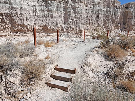
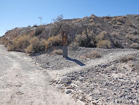
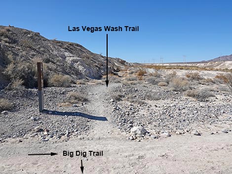
Continuing east, the Las Vegas Wash Trail runs between the wash and the bluffs, which are more like mud hills here. Soon, the trail bends right and drops back into the wash (Wpt. 14). The trail crosses the wash, and hikers should again notice the gravel and mud sections, which are similar to the layers just seen in the bluffs. Crossing the wash, the Las Vegas Wash Trail climbs onto the south bank at the junction with the Big Dig Trail (Wpt. 06). Here, the Big Dig Trail comes down Trench K and turn to the east. The Las Vegas Wash trail, in contrast, turns to the west. A trail sign here provides distances and directions to various points. Turning west, the Las Vegas Wash Trail runs on the wash bank between the wash and the mud cliffs for a short distance before climbing somewhat steeply out of the wash following an old dirt road. At the top of the bluffs (Wpt. 15), hikers arrive at the shade structure seem from across the wash. There are also two information signs here: one to the right overlooking the wash, and the other to the left, but behind a fence that hikers get to from the shade structure. |
 Trail Rules (view SE) |
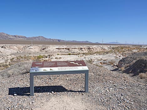
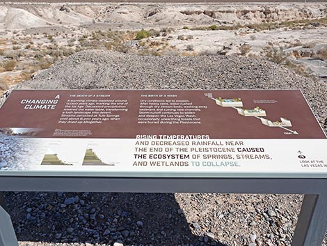
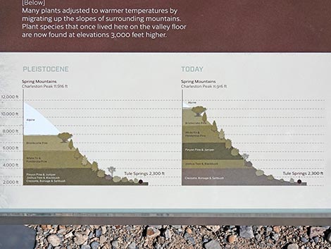
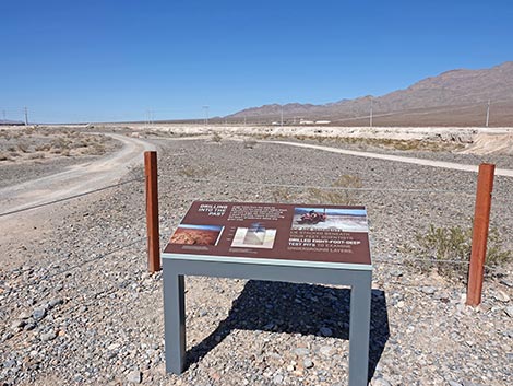
The sign on the edge of the wash: A Changing Climate, tells the story of climate change here. In particular, how plant some species moved uphill to cooler temperatures and how a drying climate led to a collapse of the marshland ecosystem that led to the wash systems we see today. The other sign: Drilling into the Past, tells the story of using boreholes, rather than trenches, to explore the layers of sediment lying beneath our feet. Continuing west, the Las Vegas Wash Trail runs along the top of the cliffs with grand views down into the wash below and the mountains above. Here, on the edge of the bluffs overlooking the wash, it seems that the soil and water conditions are slightly different than elsewhere along there trail, as evidenced by a slightly different composition of plants. Along the edge, look for the usual Creosote Bush and White Bursage, but also look for Fremont's Dalea, Nevada Ephedra, Mojave Aster, Shadscale Saltbush, and Littleleaf Ratany. |
 Trail continues past the Trail Rules sign (view NE) |
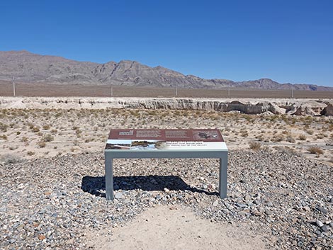
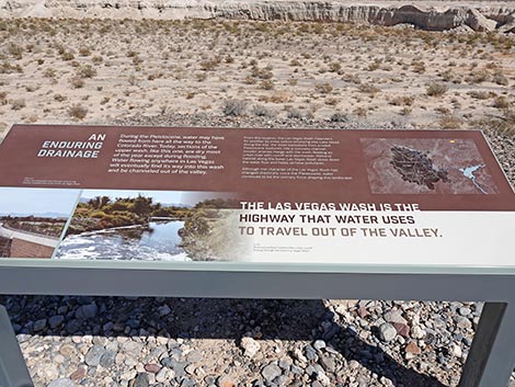
Soon hikers encounter the last sign along the trail: An Enduring Drainage, which described the Las Vegas Wash as a highway for water to flow from the surrounding mountains into the Las Vegas Valley, and then out to Lake Mead and the Colorado River. Although altered, the flowing waters still erode the landscape and transport the materials downstream, as they have for millennia. Continuing west, the Las Vegas Wash Trail runs along the top of the cliffs, but then turns away from the edge to run atop the mud hills, soon arriving back at the shade structure where the trail forked to start the loop (Wpt. 11). At the shade structure, the Las Vegas Wash Trail passes a sign seen before (Ice Age Tule Springs), and turns left. The trail crosses the service road seen before and continues southwest over mud flats and through grassy swales to the Monumental Mammoth to end at the trailhead parking lot (Wpt. 10). |
 Setting the mood: ghosts of Ice Age megafauna on the landscape (view E) |
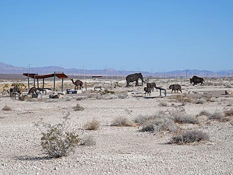 Ghosts of Ice Age megafauna on the landscape (view E) |
 The trail drops into a shallow swale |
 The swale collects rainwater and the plants take advantage of it (view E) |
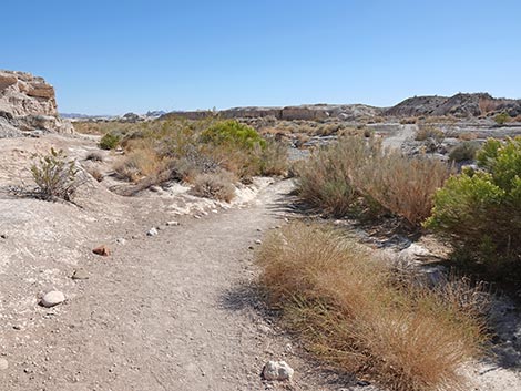
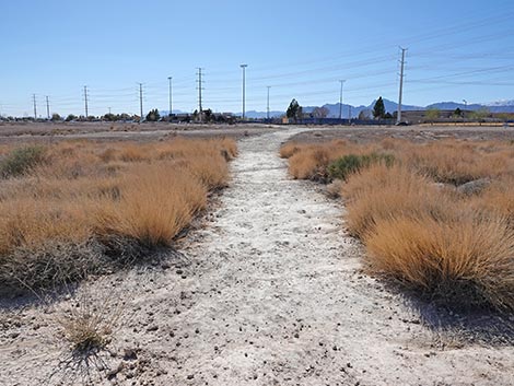
 The trail continues past the swale onto sparsely vegetated mud hills |
 Trail approaching an information sign (view E) |
 Fossil Streams: algae causes calcium carbonate to accumulate |
 Calcium carbonate can form a coating around woody branches |
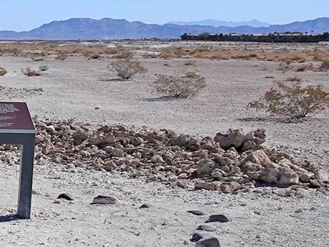 Reconstructed streambed showing tufa rocks |
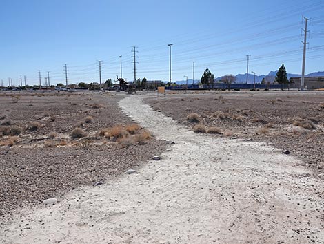
 The trail continues past the Fossil Streams sign |
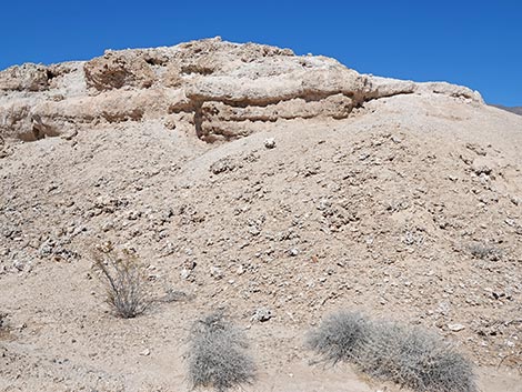
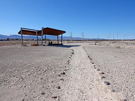
 Approaching the first shade structure (view NE) |
 Just beyond the shade structure, trail forks at information sign (view NE) |
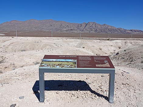 Ice Age Tule Springs sign (view NE) |
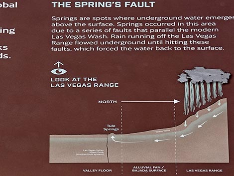 Sign detail: The Spring's Fault -- mixing hydrology and geology |
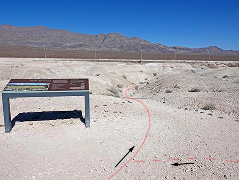 The loop starts at the sign (view NE) |
 Outbound trail starts down into a canyon in the mud hills (view NE) |
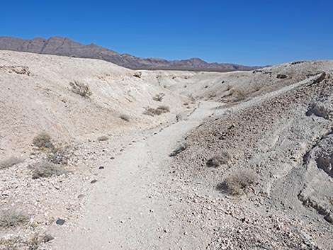 Trail winds down a canyon (view NE) |
 Trail winds down a canyon (view NE) |
 Trail winds down a canyon (view NE) |
 Trail winds down a canyon (view NE) |
 Note layers of gravel: this would have been a stream bed |
 Note layers of tufa: these layers were formed in the bottom of a marsh |
 Closeup of tufa fragments that eroded from layers above |
 Las Vegas Wash comes into view (view NE) |
 The trail approaches another information sign (view N) |
 Las Vegas Wash Trail at another information sign (view NW) |
 Sign: The Las Vegas Wash (view N) |
 A Living Wash: plants and animals that live in the wash |
 Las Vegas Wash (view NW) |
 Las Vegas Wash (view E) |
 Entering Las Vegas Wash (view NE) |
 The wash is well vegetated with shrub species (view NE) |
 Crossing gravels in the Main Branch of Las Vegas Wash (view NE) |
 Diverse and robust vegetation in the wash (view NE) |
 Three stairs lead down into North Branch of Las Vegas Wash (view NE) |
 Three stairs lead up onto the north bank of Las Vegas Wash (view NE) |
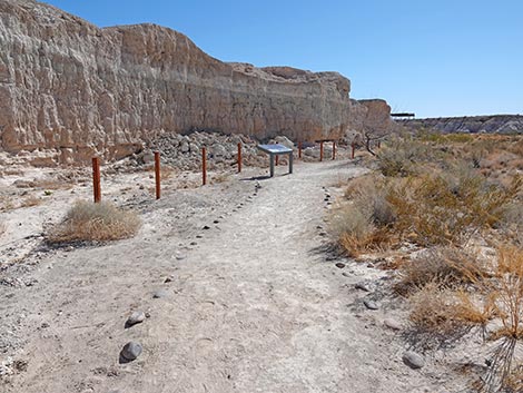 Approaching another sign under mud cliffs (view E) |
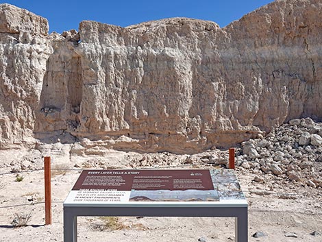 Sign: Every Layer Tells a Story (view NE) |
 Sign explains layering and time frame (oldest at bottom) |
 Sign shows example photos of the layers |
 Mud layer (B3) with stone fragments |
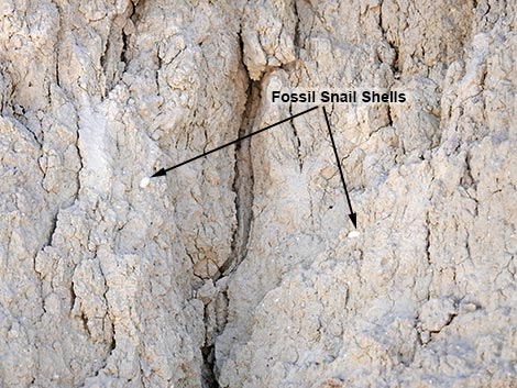 Mud layer (B2) with fossil snail shells |
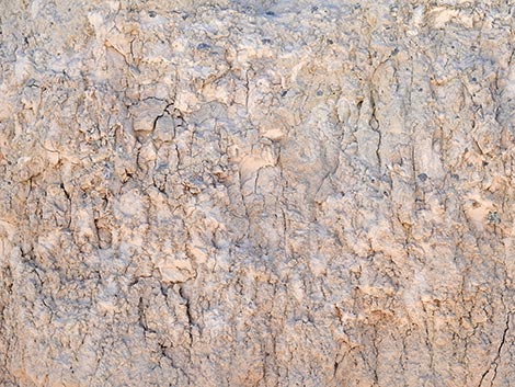
 Mud cliff with stream-bed gravel layers (view NE) |
 Gravels from an ancient stream bed recorded in the mud cliff |
 The trail runs along the mud cliffs (view SE) |
 Lots of vegetation along the wash (view SE) |
 A sign tucked in the mouth of an archaeological excavation trench (view E) |
 Sign in archaeological excavation trench (view N) |
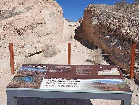 Sign: Reconstructing a Spring (view N) |
 Sign: photo of modern spring pool at nearby Corn Creek (view N) |
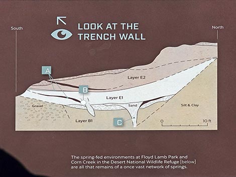 Sign: schematic drawing of the trench wall |
 Sign: the trench wall used for the schematic drawing (view NW) |
 The trail continues along the wash |
 The trail continues along the wash |
 The next shade structure is visible across the wash (view SE) |
 The trail drops back into Las Vegas Wash (view SE) |
 Crossing the Main Branch of Las Vegas Wash (view SE) |
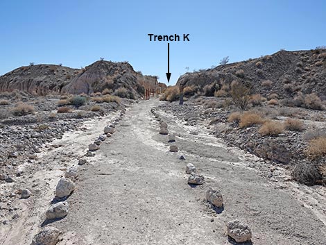 Exiting the wash towards Trench K (view S) |
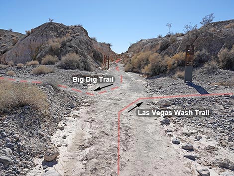 Las Vegas Wash Trail meeting Big Dig Trail (view S) |
 Las Vegas Wash Trail turns away from Big Dig Trail (view SW) |
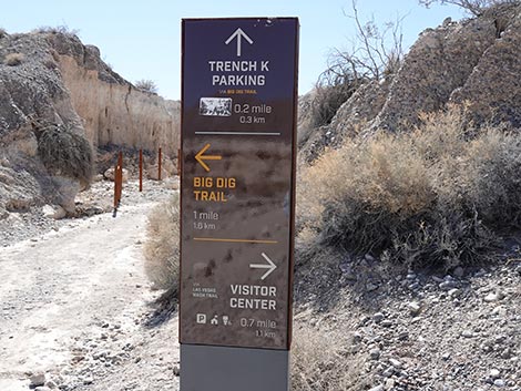 Trail junction directional sign: Visitor Center to the right (view S) |
 Las Vegas Wash Trail turns away from Big Dig Trail (view SW) |
 Las Vegas Wash Trail runs along base of cliffs (view W) |
 Las Vegas Wash Trail continues along the edge of the wash (view W) |
 Las Vegas Wash Trail approaching exit from the wash (view W) |
 Las Vegas Wash Trail climbing out of the wash (view SW) |
 Las Vegas Wash Trail approaching the top of the cliffs (view SW) |
 Las Vegas Wash Trail approaching shade structure (view W) |
 Shade structure atop the cliffs (view SW) |
 Las Vegas Wash Trail approaching another information sign (view NW) |
 Sign at the edge of the bluffs: A Changing Climate |
 Two aspects of A Changing Climate |
 Some plant species move to cooler elevations when the climate warms |
 The marshlands collapse and the intermittent wash cuts them away |
 Sign by the shade structure: Drilling into the Past (view NW) |
 Sign: Drilling into the Past |
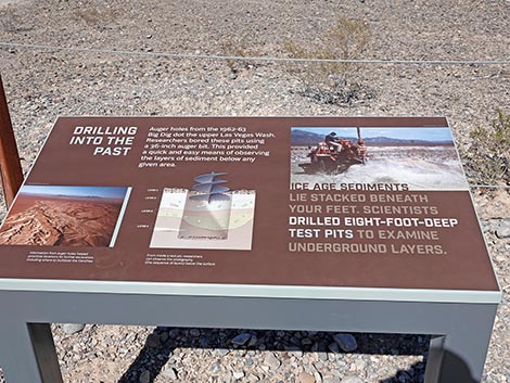 Using an auger to drill through layers of time |
 Las Vegas Wash Trail (view NW) |
 Las Vegas Wash Trail runs parallel to a service road (view NW) |
 Grand view down into Las Vegas Wash (view NNW) |
 Looking back: grand view down into Las Vegas Wash (view NE) |
 Las Vegas Wash Trail runs along the edge of the cliffs (view NW) |
 Las Vegas Wash Trail approaching another information sign (view NW) |
 Sign: An Enduring Drainage (view N) |
 How water moves through the Las Vegas Valley (view N) |
 Sign: Map of the Las Vegas drainage system |
 Las Vegas Wash Trail runs along the edge of the cliffs (view NW) |
 Las Vegas Wash Trail turns away from cliff edge (view W) |
 Las Vegas Wash Trail runs through rolling mud hills (view SW) |
 Las Vegas Wash Trail runs through rolling mud hills (view W) |
 Approaching the shade structure where the loop started (view W) |
 Las Vegas Wash Trail returning to the start of the loop (view NW) |
 Las Vegas Wash Trail continues past the shade structure (view SW) |
 Las Vegas Wash Trail crosses the service road (view SW) |
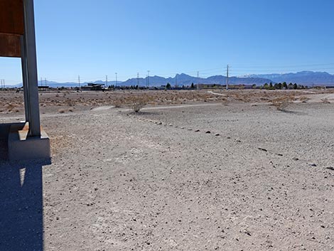
 Las Vegas Wash Trail continues across rolling desert terrain (view W) |
 Las Vegas Wash Trail dips through a swale (view SW) |
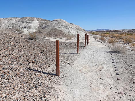
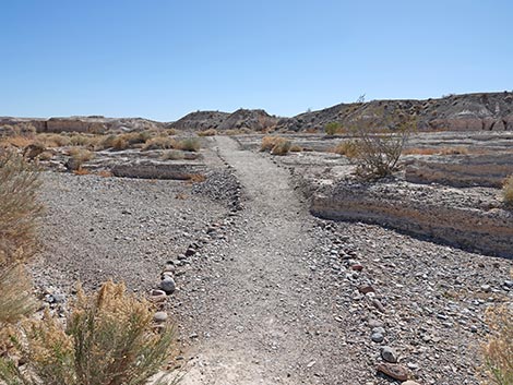
 Las Vegas Wash Trail retuning towards the Fossil Stream sign (view SW) |
 Las Vegas Wash Trail passing the Fossil Stream sign (view SW) |
 Las Vegas Wash Trail retuning towards the grassy swale (view SW) |
 Las Vegas Wash Trail retuning through the grassy swale (view SW) |
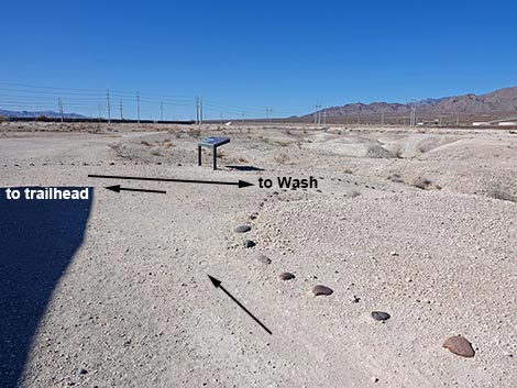
 Las Vegas Wash Trail retuning towards the Trail Rules sign (view SW) |
 Las Vegas Wash Trail passing the Trail Rules sign (view SW) |
 Las Vegas Wash Trail passing the trailhead kiosk (view SW) |
 Las Vegas Wash Trail retuning to the Monumental Mammoth (view S) |
 Las Vegas Wash Trail retuning to the trailhead parking area (view SE) |
 More to come ... |
Table 1. Hiking Coordinates and Distances based on GPS Data (NAD27; UTM Zone 11S). Download Hiking GPS Waypoints (gpx) file.
| Wpt. | Location | UTM Easting | UTM Northing | Elevation (ft) | Point-to-Point Distance (mi) | Cumulative Distance (mi) |
|---|---|---|---|---|---|---|
| 10 | Trailhead | 661079 | 4020602 | 2,359 | 0.00 | 0.00 |
| 11 | Trail Junction | 661413 | 4020853 | 2,350 | 0.29 | 0.29 |
| 12 | Edge of Wash SW | 661642 | 4020952 | 2,317 | 0.17 | 0.46 |
| 13 | Edge of Wash NW | 661804 | 4021002 | 2,312 | 0.11 | 0.58 |
| 14 | Edge of Wash East | 661949 | 4020813 | 2,305 | 0.17 | 0.75 |
| 06 | Trail Junction | 661965 | 4020724 | 2,315 | 0.06 | 0.80 |
| 15 | Descent into Wash | 661845 | 4020759 | 2,335 | 0.09 | 0.89 |
| 11 | Trail Junction | 661413 | 4020853 | 2,350 | 0.31 | 1.20 |
| 10 | Trailhead | 661079 | 4020602 | 2,359 | 0.29 | 1.49 |
Happy hiking! All distances, elevations, and other facts are approximate.
![]() ; Last updated 250304
; Last updated 250304
| Hiking Tule Springs | Hiking Ice Age Fossils | Hiking Around Las Vegas | Glossary | Copyright, Conditions, Disclaimer | Home |